In a city as vast and complex as Los Angeles, every decision about land use and zoning carries ripple effects for public safety. While most Angelenos think of zoning as a tool to manage housing, business, or open space, it also plays a critical—yet often overlooked—role in shaping how people can safely evacuate during emergencies. From wildfires in the hills to flooding in the valleys, the way neighborhoods are built directly affects how quickly residents can move to safety.
Understanding Zoning and Its Impact on Mobility
At its core, zoning dictates what can be built where—residential, commercial, industrial, or open space. But beyond regulating land use, zoning also determines street width, infrastructure density, and population concentration, all of which influence how evacuation routes function.
Table of Contents
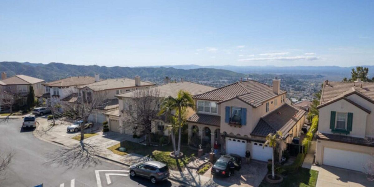
For example, neighborhoods with higher housing density often have more cars but fewer major exits. In contrast, hillside zones like those in Bel-Air or Pacific Palisades may feature winding, narrow roads that become chokepoints during wildfires. The city’s planning framework attempts to balance growth with safety, but in practice, zoning can either help or hinder evacuation flow depending on how it’s applied.
High-Density Development and Traffic Bottlenecks
In parts of Los Angeles such as Hollywood or Koreatown, high-density zoning means thousands of residents share a limited network of streets. During an evacuation—whether for fire, earthquake damage, or chemical hazards—traffic congestion can become life-threatening.
Urban planners warn that even small zoning changes, like approving large apartment complexes in already tight neighborhoods, can create critical evacuation bottlenecks. Emergency management experts emphasize that before approving new developments, city planners must consider how additional vehicles will impact escape times during disasters.
According to the Los Angeles Department of Transportation, routes with mixed-use zoning tend to be more adaptable during emergencies since they already support wider streets and public transit access. Encouraging this kind of mixed-use, low-rise design could be key to balancing growth and safety.
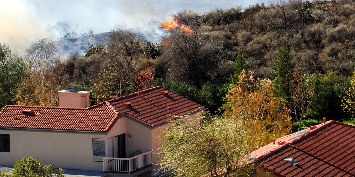
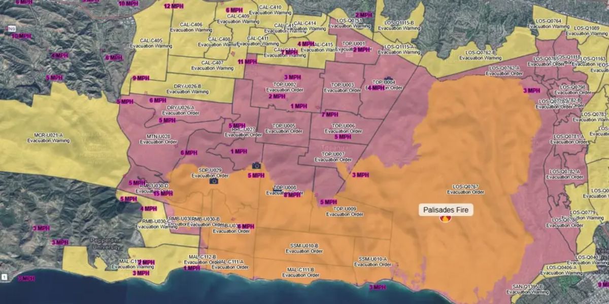
Wildfire Zones and the Hillside Challenge
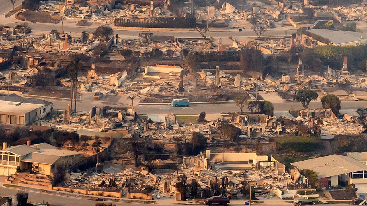
Nowhere is zoning’s impact on evacuation more visible than in Los Angeles’ Very High Fire Hazard Severity Zones (VHFHSZ)—areas like Brentwood, Laurel Canyon, and Topanga. These neighborhoods are zoned for low-density, single-family homes, but the narrow roads, steep grades, and limited access points create significant evacuation challenges.
During the 2019 Getty Fire, for instance, residents faced gridlock as evacuation routes converged onto a handful of major roads. In some hillside areas, zoning restrictions on new access roads or secondary exits have left entire communities reliant on a single escape route.
Urban resilience experts, including the Los Angeles Fire Department’s Brush Clearance Unit, stress the importance of aligning zoning policy with wildfire evacuation planning. This means reassessing whether hillside neighborhoods should allow additional egress roads, fire breaks, or wider right-of-way requirements for safer evacuation.
Industrial Zones and Hazardous Exposure
Zoning also determines proximity between industrial areas and residential neighborhoods—an issue that becomes urgent during chemical spills or gas leaks. Parts of the San Fernando Valley and South Los Angeles contain clusters of industrial zones adjacent to densely populated blocks.
In such regions, evacuation routes must be carefully designed to move people away from potential contamination paths, not through them. City planners have started incorporating buffer zones and hazard corridors into zoning maps to mitigate risk, but legacy zoning from the mid-20th century still poses challenges.
By updating zoning laws to create clearer separation between industrial and residential uses, Los Angeles can reduce the number of residents exposed to toxic risks during an emergency evacuation.
Transit-Oriented Development and Safer Alternatives
Modern zoning trends in Los Angeles are gradually shifting toward Transit-Oriented Development (TOD), which clusters housing and services around major public transit lines. When implemented correctly, this model can enhance evacuation safety by offering multiple mobility options—not just cars.
Residents near Metro rail stations or major bus lines can often evacuate faster if private vehicle routes are blocked. However, TODs must be paired with coordinated emergency planning that ensures transit systems remain functional during disasters. Without that, high-density transit zones could experience the same congestion as traditional neighborhoods.
Equity and Access in Evacuation Planning
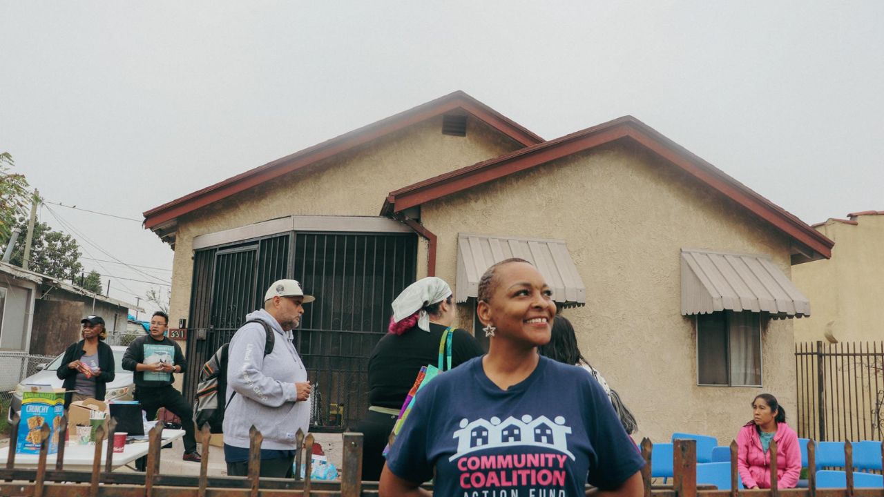
Zoning-related evacuation challenges don’t impact all Angelenos equally. Low-income and minority communities often live in older, denser neighborhoods where infrastructure is outdated or where evacuation routes intersect with industrial zones.
Addressing these inequities requires targeted investment—such as widening key exits, upgrading signage, and creating pedestrian-friendly evacuation corridors for households without cars. The City of Los Angeles Resilience Office has begun mapping vulnerable populations to integrate social equity into zoning and evacuation updates.
Planning for the Future
As climate change intensifies wildfires, floods, and heatwaves, Los Angeles must rethink how zoning interacts with emergency management. Future plans should:
- Require evacuation impact assessments before approving major developments.
- Prioritize dual access routes in hillside and high-density zones.
- Expand green buffers between industrial and residential areas.
- Integrate public transit evacuation protocols into zoning and city planning.
By connecting land-use policy with real-world evacuation behavior, Los Angeles can make neighborhoods both livable and safe.
Final Thoughts
Zoning may seem like a technical issue reserved for planners and policymakers, but it directly affects how quickly families can reach safety when every second counts. As Los Angeles continues to grow and rebuild, aligning zoning with evacuation design isn’t just good planning—it’s lifesaving.
Have thoughts on how your neighborhood could improve its evacuation routes? Share your ideas and experiences in the comments below at bereadyla.org to help make Los Angeles safer for everyone.